

Coop Tour Century – 100 Miles
Starting location:
Burgess Park 701 Laurel St.
Menlo Park, CA 94025
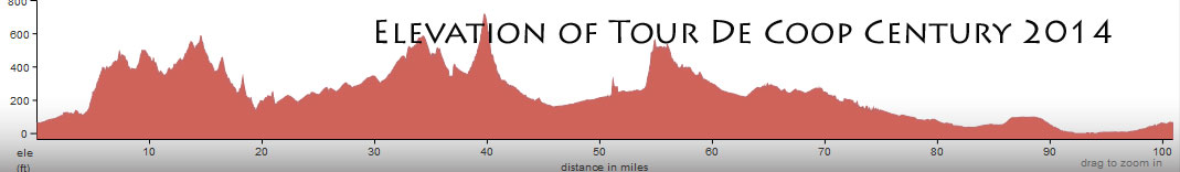
This is one major coop tour! 100 miles.. Many coops. 3500+ vertical feet of climbing
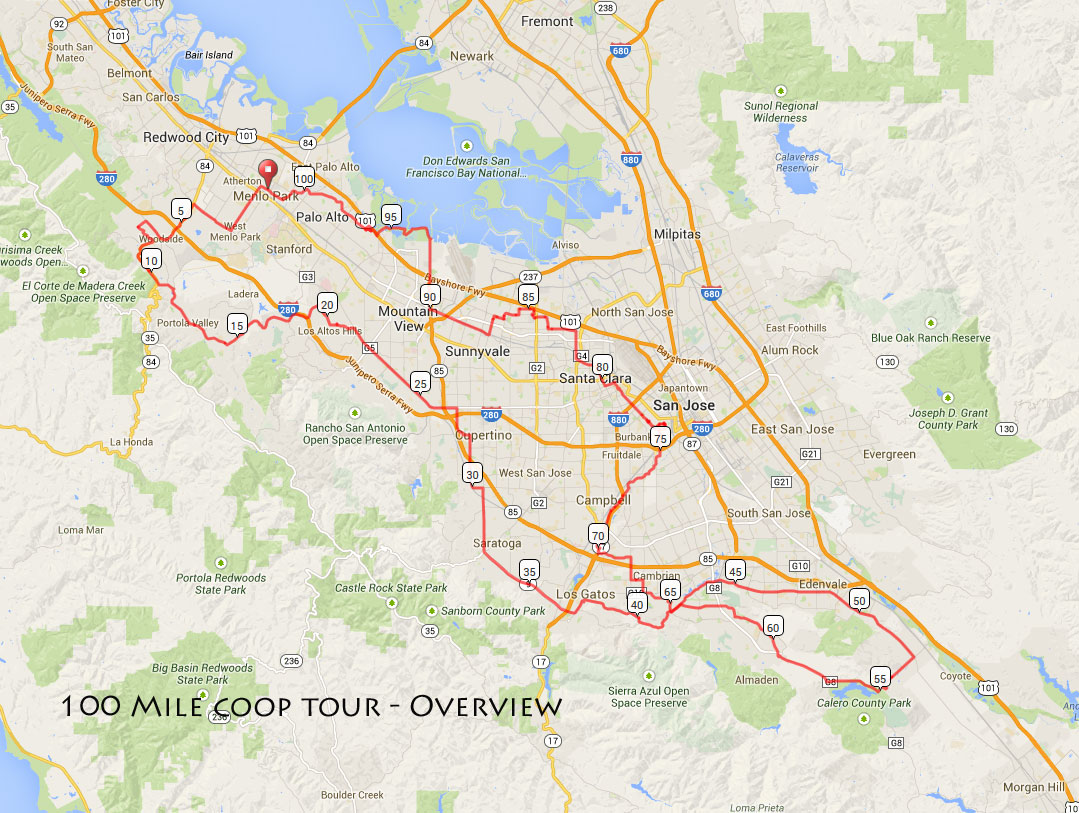
It starts in Menlo Park and heads into Woodside, to Los Altos area, to South San Jose and then back through Sunnyvale, Mtn View, Palo Alto and back to MP.
This ride is designed for the serious and competent cyclists comfortable with riding with any type of traffic and also navigating a longer route.
All of the ride details (lefts, rights, road names, etc) may not have been fully tested due to our limited time and resources so those doing this ride should be able to get past any errors and missed turns in the route and cue sheets. Have your smart phone ready.
Click on the maps for more detail – and use the cue sheet!
Here is the map showing the whole route on one page (click on map to enlarge)
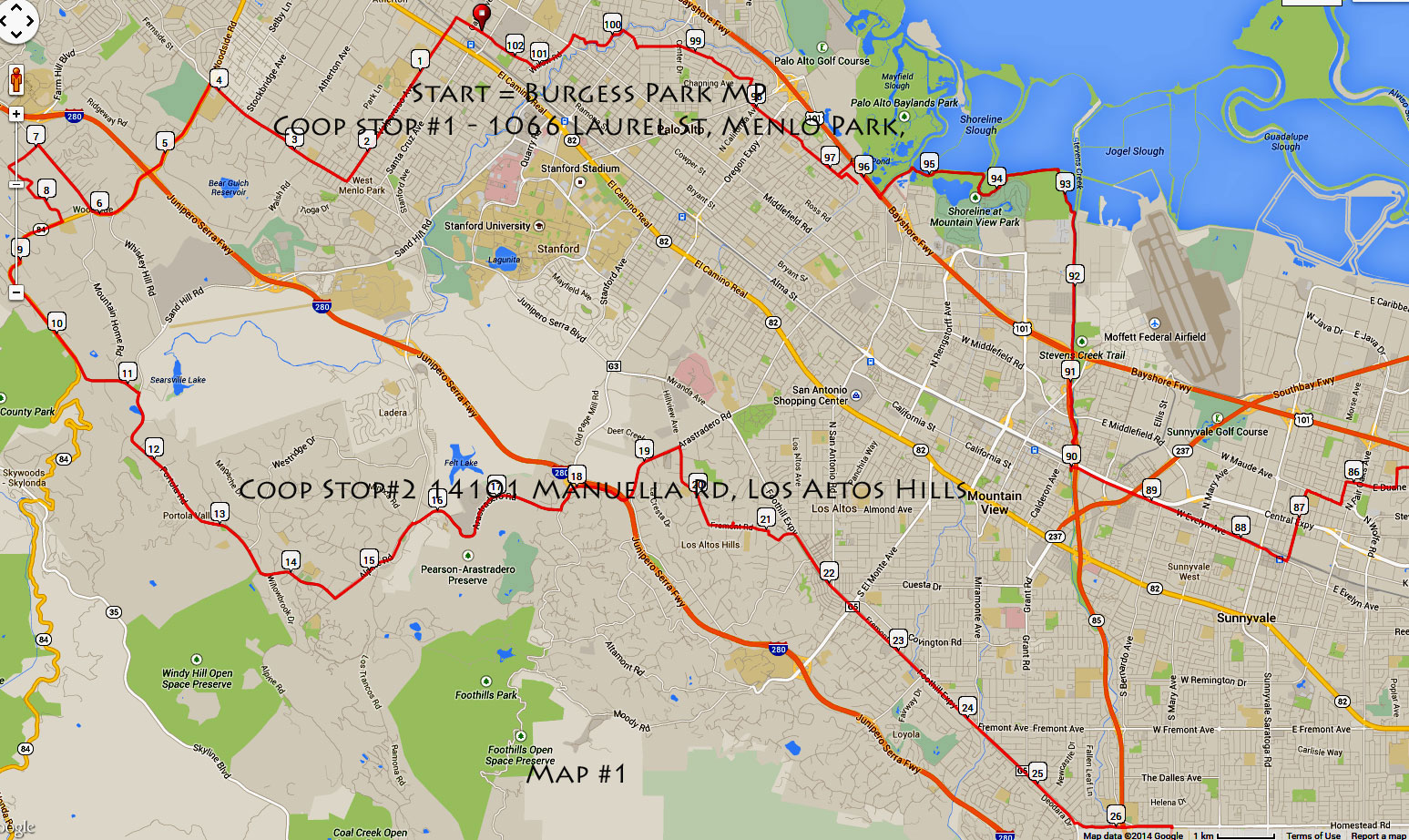
Map #1 – Ride starts at Burgess Park – 701 Laurel Street –
This part takes you west into Woodside, portola Valley into Los Altos Hills and Los Altos
Map #2 – Takes you south into Saratoga, Los Gatos and South SJ
Map #3 takes you into Almaden Valley
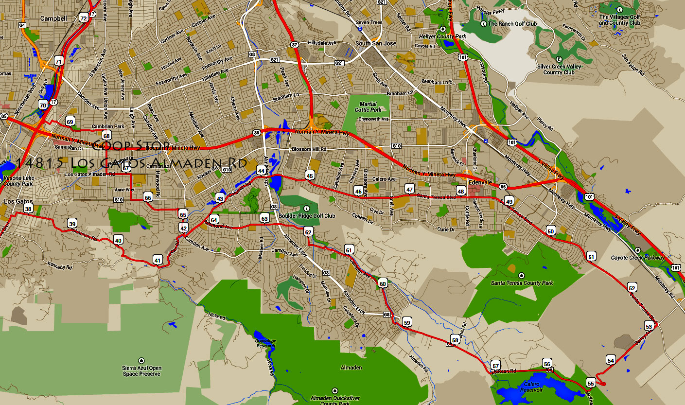
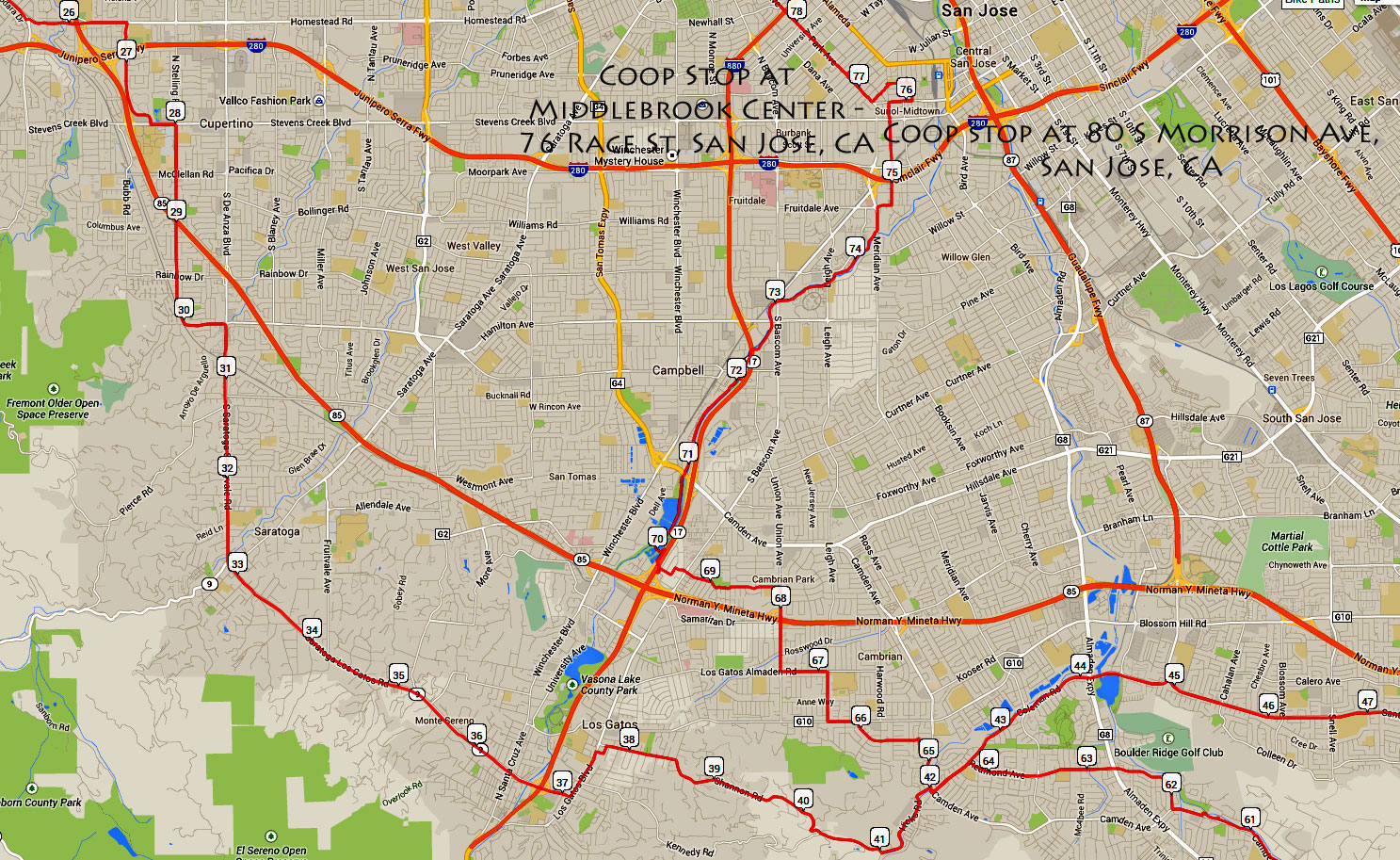
Map 4 (same as 2) takes you through Campbell and San Jose, toward Santa Clara
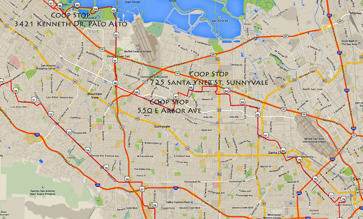
Map 5 – Takes you to Sunnyvale, and Mountain View and Palo Alto
Map #6 – Returns back to Menlo Park
IMPORTANT: Coops are only open from 9 AM to 4 PM Sunday September 21,2014. If you start early, or finish late, some coop stops will be closed.
Tour_de_Coop_Century9152014_cue
